Chicago weather: Arctic blast arriving this weekend


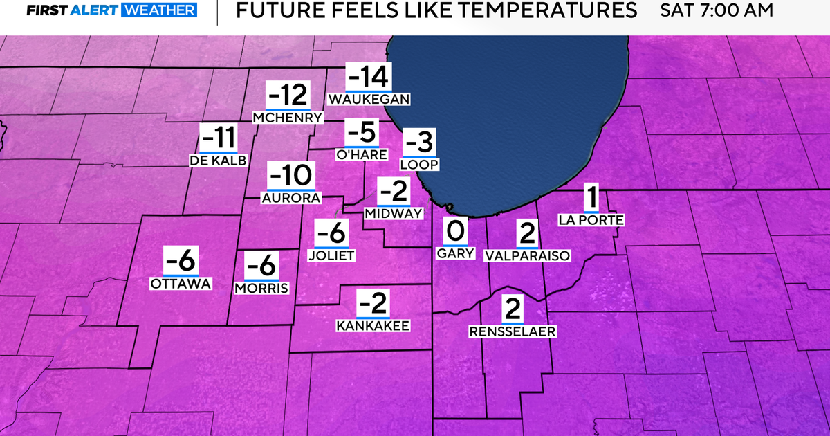
The coldest temperatures of the season blow in Friday night through the weekend. Wind chills will plunge into the 15 to 25 below zero range Saturday night into Sunday morning, with subzero wind chills lingering throughout Sunday. Cold Weather Advisories appear likely.
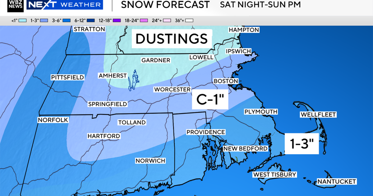
A fresh round of accumulating snow is also expected Saturday, with the highest totals—2 to 3 inches—most likely south of I-80. Chicago can expect a dusting up to one inch, as the heavier snow remains south. A Winter Weather Advisory may be issued south of I-80.
The weather pattern then begins a notable shift early next week. Temperatures will start to rebound into the teens and 20s Monday, with gradually moderating winds. A weak disturbance could bring pockets of drizzle Tuesday night or Wednesday as temperatures climb closer to freezing. By late week, expect a milder, less snowy pattern as the arctic air retreats northward.
Here is your 7-day forecast:
Saturday: Light snow, windy. High: 11, Low: -1
Sunday: Wind chills -15 to -30. High: 13, Low: 2
Monday: Wind chills -5 to -15. High: 24, Low: 18
Tuesday: Partly cloudy. High: 36, Low: 31
Wednesday: Cloudy. High: 45, Low: 37
Thursday: Scattered showers. High: 45, Low: 24
Friday: Mostly cloudy. High: 38, Low: 22
Get more First Alert Weather from CBS News Chicago
CBS Chicago Radar | Regional Radar | Regional Satellite and Radar | West Suburbs Weather Radar | Central Suburbs Weather Radar | South Suburbs Weather Radar | Northwest Indiana Weather Radar | North Suburbs Weather Radar